First attempt at a blog post, be kind! We've had a few questions on YouTube about what we use onboard, so hoping to answer those in a more detailed post.
When we came to splash Bohemia after a few months on the hard, one thing we noticed - right after checking the bilges for leaks and remembering how to back against the prop wash - was that the chartplotter on the helm station wasn't working. It didn't affect the short passage back to the marina, and weeks later it's not even on my priority list to fix (don't tell the First Mate!).

When we were in the US and new to sailing, we relied heavily on our 20-year old Raymarine RL70RC Plus (complete with COLOUR display!), trusting its old cMap charts almost without question. Something that is unlikely to land you in much trouble in US waters. But I'll never forget the first time we arrived in Mexico. We were tired after a nasty overnight passage and had decided to make a pitstop in the remote Benitos Islands to catch up on our sleep. As we came up on the islands something immediately seemed wrong. It didn't take a lot of guesswork even for our tired minds to work out that the pass in front of us was shown quite clearly as a hard, rocky, yellow patch of land according to our trusty chartplotter. Turning on the radar (the one thing I love about even our old plotter is that it'll overlay radar images on top of the charts) confirmed that the everything was off by a crucial mile just when we needed reliable navigation.
 |
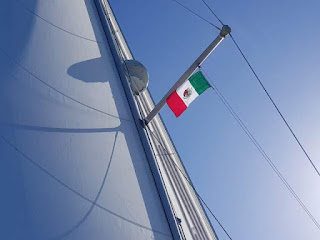
Not the first thing you want to face after a sleepless night watch.
The Benitos Islands on Baja California's Pacific Coast, where the
cMap chart datum was WAYY off, which is typical in
much of Mexico.
|
 |
| Bohemia likes to make an entrance in any anchorage! |
Of course, we had been warned about the reliability of charts for Mexico, and we did know that our old cMap data couldn't be trusted. But there's nothing quite like seeing your recorded track of the boat go right through that bright yellow landmass, circle a couple of times and drop anchor on a hill, to drive the point home. Ever since then the Raymarine has been a second class citizen on Bohemia.
The reason why we can do without this seemingly essential piece of navigation equipment is that we use another chartplotter much more frequently.
OpenCPN is a free open source app (
Android, Windows, Linux. Sorry iPhone and iPad users!) which can interface with the boat's systems and work with a huge collection of different charts, route planning, etc. Confusingly for a 'free' app, the developer charges for the Android version linked above, but it's $10 well spent. Do not use the older, free version in Google Play by 'Maison Automatique', you'll have a bad time. As an open source app, you can of course compile it yourself if you don't want to part with the $10 and are happy to keep up with the updates.
Most people have an old phone or two lying around. We fitted a USB charger to the helm and bought a
RAM mount to fix it securely to the binnacle and it became our navigation phone - luckily it was already waterproof.
We use a Vesper Watchmate XB-8000 AIS transponder. Worthy of a blog post all to itself, I'll just mention that this was a key piece of kit to make OpenCPN as useful as it has been so far. It has a WiFi connection, so right out of the box can connect to the 'navigation phone', sending accurate high frequency, filtered GPS positions and the positions of other nearby boats, direct to the app. Add a couple of charts and it's already more useful than the old Raymarine museum piece! There's nothing quite like overlaid AIS data at the helm to give you peace of mind when crossing one of California's busy shipping lanes!
 |
Looking a little crowded!
Typical view of overlaid AIS
data from Vesper on OpenCPN
|
Charts
Again if you're sailing in the US, this question is moot. Uncle Sam provides fantastic raster and vector charts of US waters for free, and OpenCPN even has a handy chart downloader feature to grab them all for you whenever you have an internet connection. Done. Go sailing ;-)
If you're venturing further afield, things start getting complicated. To keep this post short and somewhat authoritative, I'll simply stick to our experience in Mexico so far and two crucial resources that have worked well for us on OpenCPN.
 |
Digital copies of Sean & Heather's Mexico charts loaded
in OpenCPN have been invaluable on our travels so far
|
Sean & Heather/Blue Latitude Press - Lovingly referred to down here as 'The Sean and Heather Guide' this cruising couple need a blog post of their own too. They write THE two canonical cruising guides for Mexico - Pacific and Baja. Sean also happens to be a skilled cartographer who has painstakingly plotted the readings from his boat's depth sounder and a zoomed around for hours in his dinghy charting almost every popular anchorage on Mexico's West coast. These charts aren't free, but they're worth every penny if you're cruising Mexico. My only gripe is that they're shipped through the official O-Charts store for OpenCPN, which annoyingly limits you to using them on two devices and prevents you from changing devices once activated. Probably fine for most sailors but Bohemia's geeky crew would welcome a couple more backup devices. Also worthy of note are Sean & Heather's anchorage and hazard
waypoints in digital format that can be imported directly into OpenCPN. Having these two tools at your helm take almost all of the guesswork out of navigating in Mexico.
Oh, and BUY THE GUIDE before you leave the US if you're headed down here, it's almost impossible to buy in Mexico. You might even recognize a couple of drone shots from yours truly in the latest edition, fame at last!
Bruce Balan's Chart Locker - Another cruiser and friend of ours, Bruce on Migration has gone to a lot of trouble to provide free charts and aerial photos that can be loaded straight into OpenCPN. Not content with just Mexico, his charts cover most of Central America and the South Pacific islands too. There are detailed Navionics charts and Google/Bing aerial shots in multiple resolutions. They're huge files and updated semi-regularly, so my advice is to grab only the ones you need, and check back later (with a good internet connection!) when you're about to 'sail off the map' and move into a new area.
Chart groups
Finally with all this charting power at your fingertips, you'll NEED to use OpenCPN's chart groups feature. 'Clunky' is the nicest way I can describe this interface, but take some time to figure it out or you'll go insane trying to enable and disable individual charts with the weird purple pill-like buttons at the bottom of the screen. On laptops, use the number buttons on the keyboard to flick between groups quickly. On Android, long press the chart screen and select a group from the pop-up menu - it took me ages to figure that out, you're welcome!
I found that using groups for each chart source is the best way to go. We have a group for e.g. 'SeanHeather', 'GoogleAerial', 'Navionics', 'cMap' (when we'r e feeling brave!). That way you can move and zoom without tons of noise clouding your screen. Even with chart groups it's worth removing any areas you're not actively using to stop OpenCPN getting too bogged down with data.
That's it, I hope you find it useful if you're planning a trip to the fun side of the wall. I'll leave it there before I geek out on exotic instrument data, Raspberry Pi logging and SignalK onboard. Maybe a topic for a future post.
As this is the first ever post, I'd love to hear from you in the comments if you found it useful and if anything, what you'd like to hear more about from Bohemia's escapades.
Cautionary note
I should probably put in some sage wisdom about having paper backups and a sextant and not relying too much on your electronics to sail for you. But you're all smart people, so I won't.

Woo, glad to see this. I was one of those that asked for this info.
ReplyDeleteGood call on not using the older free version of OpenCPN in Android store, however Id like to point out that you can compile latest version for Android from source if $10 is too much (or simply out of principle hehe).
And yep, there sadly isnt an iOS version (new iPads are 1000 nits, much easier to see in the sun, same brightness as chart plotters). You have a tiny typo here --> (Android, iOS, Windows, Linux. Sorry iPhone and iPad users!) You mention iOS but then say its not on iPhone or iPad.
Very much looking forward to a blog post on XB-8000. Curious if you guys have tried relying on phone's GPS, was it inaccurate?
What phone do you use and while it is waterproof, has it shown any signs of corrosion or trouble in the 2+ years at sea? Are you using any kind of case on it? Hows your experience with RAM mount?
Have any of your electronics gone bad since you sailed? Rpi is very exposed, hows that holding up?
Havent heard of Chart Locker before, looks awesome and super useful!
Thanks for making this post!
Hola Duxa and thanks for the comment! Turns out I didn't have email notifications enabled so the reply is slow but glad you found it helpful. I'll amend the post with a couple of your notes.
DeleteWe use a 4 year old Samsung Galaxy Note somethingorother (I don't have the exact model to hand) but it has held up well to the harsh environment. It's waterproof, which helps of course. It has a bright daylight capable screen too, though I doubt it's a match for the brightness of a plotter or the new iPad you mentioned. We have it in a rubberized case just to protect the corners if it's dropped, but it doesn't add any waterproofing. One thing I did was enable the developer options, then turn the screen to 'always on while plugged in' which is essential for use as a plotter. Regardless of this setting, the screen does dim after 15 mins of inactivity which can get a bit annoying if you're not using it all the time... maybe there's a way to stop that? I have noticed the screen is showing some burn-in from the Android title bars, e.g. the OpenCPN title bar on full brightness for a few years, but nothing that would stop you using it.... we'll see how that develops.
Love the RAM mount... seriously sturdy and zero signs of deterioration after 4 years. A bit pricey up front but IMO well worth it for the long run. We have a couple of other mount points around the cockpit and the boat so we can move the phone around while underway.
It's charging just fine via a 12v Blue Sea USB outlet at the helm. The cable and the charging port are showing signs of corrosion but we've had 4 years of sailing out of this setup so they don't owe us anything at this point!
Regarding the phone GPS... we disable it. I like having it as a backup if all else fails, but it always takes AGES to get a fix without network connectivity. Also we want to have the other instrument/AIS data piped into the phone so you might as well take the GPS with it if you have something outputting it.
No major issues with electronics so far, touch wood. My main paranoia is a lightning strike, so we keep a couple of old phones as backups, which go into the microwave (don't laugh, serious sailors, it came with the boat!) if there's a storm.
I did accidentally fry my first Rpi with a cheap voltage regulator instead of a proper PSU... but I'll take the blame for that. We keep it out of the elements as much as possible but I don't expect it to last more than maybe 3 years before the board gets corroded... maybe I can try some T-9 on it or something if I'm feeling brave!
Cheers and fair winds!
Thanks for the detailed reply. I was going to ask about USB cable, I would think that being in the sun the rubber would dry out and start cracking. Luckily those are a few bucks to replace. No corrosion in the charge port of the phone? How are you running the cable (curious if any attempts are made to keep it out of the sun/spray or if it just dangles).
DeleteIll have to look if OpenCPN has such an option but other charting apps have a "always on" option that prevents the screen from dimming. Dont have the phone handy right now to check.
Another question I had is how you feel about the screen size for charting? Do you think a large-ish phone is all you need? or do you think you'll upgrade to a tablet at some point?
Looking forward to more videos and blog posts. Cheers.
We don't do anything special for the cable and no issues so far from soon and salt. We do store it all down below when not sailing.
ReplyDeleteScreen size is fine for navigation. I would like a tablet but it would get in the way, would have to find another place to mount it. The only thing I'd use the larger screen for is instrument data and gadgets TBH though.
Glad you're finding it useful!
Cheers
Tom